Flood Risk in Malaysia: The One Thing Most Listings Won't Tell You
timer
6 minutes read
April 22, 2026
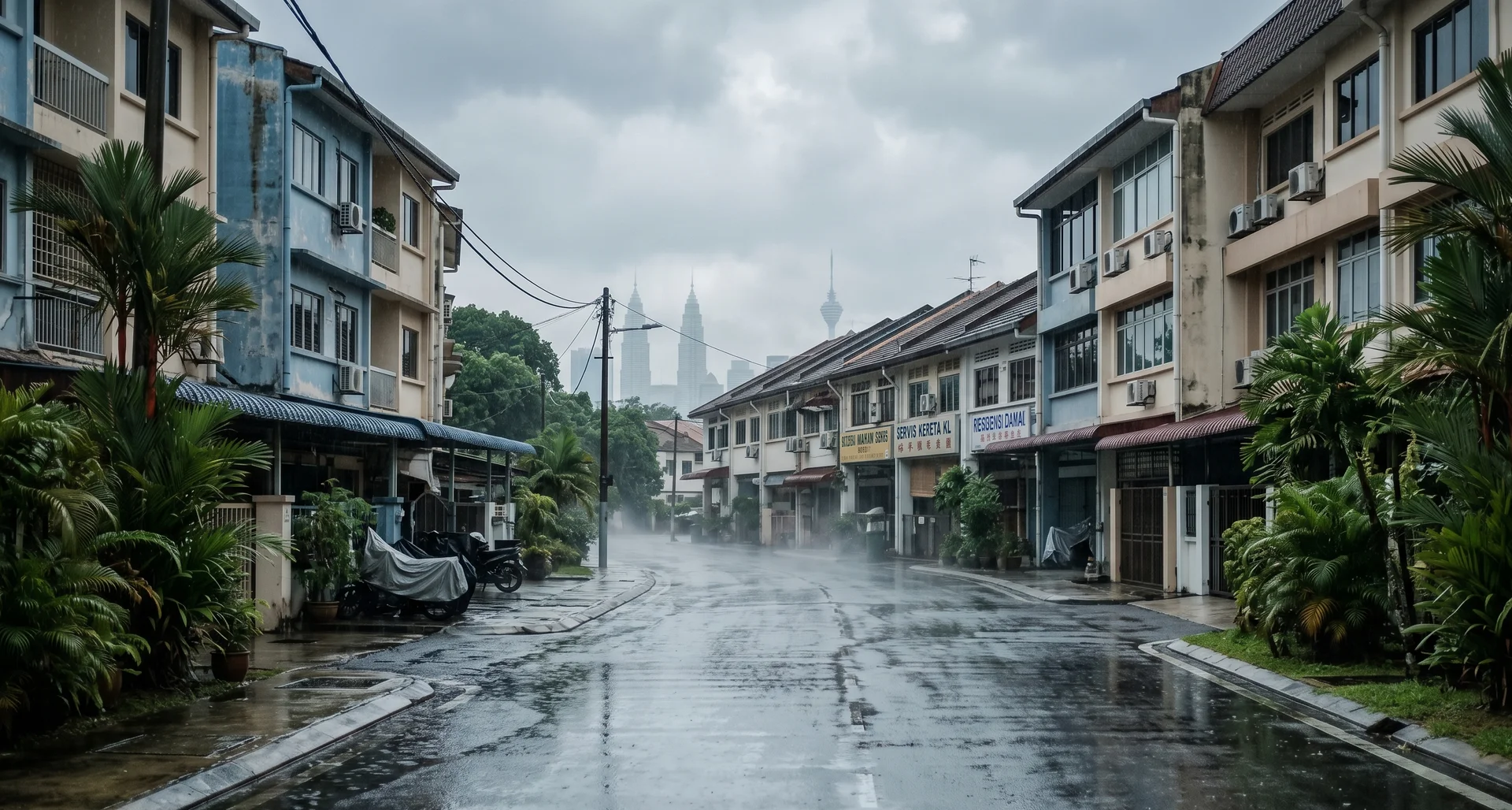
On 20 April 2026, flash floods hit the Klang Valley again. Heavy rain triggered flooding and fallen trees across several parts of the valley, snarling the evening rush. [New Straits Times] TTDI got mud-flooded twice in three days. Jalan Ampang Hilir and Jalan Kuching were underwater by the next morning.
It's a familiar story. Flooding is the most predictable — and most ignored — variable in Malaysian property. This piece looks at why, and at what buyers can actually do about it.
Malaysia had the highest share of its population exposed to floods among ASEAN countries between 2012 and 2019 — roughly 67%. [Copernicus] Two out of every three Malaysians live in a flood-exposed area.
The reasons are familiar: monsoon rainfall, climate change adding intensity, and urbanisation paving over land that used to absorb water. The TTDI mud floods this month — traced to a collapsed retaining wall on a Bukit Kiara slope project — were a textbook case. One poorly-managed hillside, several flooded streets downhill.
Flood risk affects four things that hit your wallet:
Valuation and financing. A flood history slows sales and can pull down bank valuations.
Insurance. Standard fire insurance in Malaysia doesn't cover flood. You need a flood extension — and in repeat-flood zones, premiums climb or cover gets capped.
Livability. Damaged cars, ruined renovations, disrupted commutes. KL alone recorded RM32 million in flood losses in 2021 — RM22.4 million of that in housing. [Free Malaysia Today]
High-rise buyers aren't immune. Units upstairs are fine. Basement carparks, lifts, and lobbies are not.
Here's the honest problem. Malaysia already has excellent flood data — it just lives where buyers don't look.
The Department of Irrigation and Drainage (Jabatan Pengairan dan Saliran, or JPS/DID) — Malaysia's official flood authority — runs a national network of river-monitoring stations and publishes live water-level data through its InfoBanjir portal at publicinfobanjir.water.gov.my. PDRM publishes district-level crime data via data.gov.my. Municipal councils and news archives fill in the rest.
None of it reaches you during a typical property search. You get photos, a price, and a floor plan. If you want the risk picture, you open five browser tabs and start piecing it together yourself.
Most property platforms are built to present a listing in its best light — it's how the business model works.
MyRumahBaru is built the other way around. We show you the good and the bad, and let you decide.
Every MRB listing carries two risk panels, pulled from the same government sources you'd have to open tabs to find:
Area flood risk — live river-discharge readings from the nearest DID monitoring station (current, 30-day average, 30-day peak), a two-year historical flood record, a 12-month monsoon risk profile, and a direct link to DID's InfoBanjir portal. Sourced from the Department of Irrigation and Drainage (JPS/DID) and Open-Meteo.
Area crime — district-level safety data from PDRM, via data.gov.my.
Both panels are labelled honestly: area-level risk, based on the nearest monitoring station, not the specific unit. The listing-page data is a starting point; a site visit and InfoBanjir check are still the final step.
We're not generating new risk assessments — the government already does that. We're just putting the work the government has already published on the same page as the listing, so you don't have to corroborate it across seven sites on your own.
That's the philosophy: every listing, good and bad, side by side — you choose.
Check the listing's Area flood risk panel on MRB for a baseline.
Cross-reference DID's InfoBanjir portal directly.
Google the street name plus "banjir" or "flood" — repeat hits across years are a red flag.
Ask neighbours and the management corporation about drainage, pumps, and basement-carpark history.
Inspect the physical site — look for water marks, raised thresholds, sandbag storage.
Flooding is Malaysia's most common natural hazard, and climate change is making it worse.
Flood risk affects valuation, insurance, livability, and resale — it belongs in every due-diligence checklist.
The data you need already exists, published by DID, PDRM, and DOSM — but it usually doesn't reach buyers before they sign.
MRB surfaces that data — Area flood risk (DID + Open-Meteo) and Area crime (PDRM) — on every listing, so you see the full picture in one place.
[How to buy your first home in Malaysia: a complete guide for young professionals]
[Overdevelopment or NIMBY? The Taman Desa and Bukit Damansara debates show KL's planning fault lines]
[Why now is the time to rethink how Malaysians buy, sell and rent property]
Q: Is flooding a major risk for property buyers in Malaysia?
A: Yes. Malaysia has the highest flood exposure in ASEAN, with roughly two-thirds of its population living in flood-prone areas. Climate change and urbanisation are intensifying the risk, making flooding a recurring — not occasional — property concern.
Q: Which authority tracks flood risk in Malaysia?
A: The Department of Irrigation and Drainage (Jabatan Pengairan dan Saliran, JPS/DID) is Malaysia's official flood and water-resource authority. DID operates the national river-monitoring network and publishes live water-level data and alerts through its InfoBanjir portal at publicinfobanjir.water.gov.my.
Q: Does standard home insurance in Malaysia cover flood damage?
A: No. Standard fire and houseowner policies typically exclude flood. Buyers need to add a flood extension. In repeat-flood zones, premiums are higher and cover may be restricted — check with your insurer before finalising your loan.
Q: How does MRB help buyers assess flood risk?
A: Every MRB listing includes an Area flood risk panel built on live data from the Department of Irrigation and Drainage (JPS/DID) and Open-Meteo. It shows current river discharge, two-year flood history, and a monthly monsoon risk profile — with a direct link to DID's InfoBanjir portal. A parallel Area crime panel uses PDRM data from data.gov.my. Both panels show area-level risk, not unit-level.
Q: Are high-rise units safe from flooding?
A: The units themselves usually are, but shared infrastructure isn't. Basement carparks, lifts, and utility rooms in flood-exposed areas have been inundated in past events. Check carpark elevation, flood gates, back-up pumps, and the building's sinking fund before buying.
Written by MRB Editorial Team · Published 21 April 2026 · Flood data referenced in this article is sourced from the Department of Irrigation and Drainage (JPS/DID) Malaysia and Open-Meteo. For real-time water-level updates, visit publicinfobanjir.water.gov.my.
It's a familiar story. Flooding is the most predictable — and most ignored — variable in Malaysian property. This piece looks at why, and at what buyers can actually do about it.
Flooding isn't rare. It's structural.
Malaysia had the highest share of its population exposed to floods among ASEAN countries between 2012 and 2019 — roughly 67%. [Copernicus] Two out of every three Malaysians live in a flood-exposed area.
The reasons are familiar: monsoon rainfall, climate change adding intensity, and urbanisation paving over land that used to absorb water. The TTDI mud floods this month — traced to a collapsed retaining wall on a Bukit Kiara slope project — were a textbook case. One poorly-managed hillside, several flooded streets downhill.
Why it should matter when you're buying a home
Flood risk affects four things that hit your wallet:
Valuation and financing. A flood history slows sales and can pull down bank valuations.
Insurance. Standard fire insurance in Malaysia doesn't cover flood. You need a flood extension — and in repeat-flood zones, premiums climb or cover gets capped.
Livability. Damaged cars, ruined renovations, disrupted commutes. KL alone recorded RM32 million in flood losses in 2021 — RM22.4 million of that in housing. [Free Malaysia Today]
High-rise buyers aren't immune. Units upstairs are fine. Basement carparks, lifts, and lobbies are not.
The information gap
Here's the honest problem. Malaysia already has excellent flood data — it just lives where buyers don't look.
The Department of Irrigation and Drainage (Jabatan Pengairan dan Saliran, or JPS/DID) — Malaysia's official flood authority — runs a national network of river-monitoring stations and publishes live water-level data through its InfoBanjir portal at publicinfobanjir.water.gov.my. PDRM publishes district-level crime data via data.gov.my. Municipal councils and news archives fill in the rest.
None of it reaches you during a typical property search. You get photos, a price, and a floor plan. If you want the risk picture, you open five browser tabs and start piecing it together yourself.
Where MRB is different
Most property platforms are built to present a listing in its best light — it's how the business model works.
MyRumahBaru is built the other way around. We show you the good and the bad, and let you decide.
Every MRB listing carries two risk panels, pulled from the same government sources you'd have to open tabs to find:
Area flood risk — live river-discharge readings from the nearest DID monitoring station (current, 30-day average, 30-day peak), a two-year historical flood record, a 12-month monsoon risk profile, and a direct link to DID's InfoBanjir portal. Sourced from the Department of Irrigation and Drainage (JPS/DID) and Open-Meteo.
Area crime — district-level safety data from PDRM, via data.gov.my.
Both panels are labelled honestly: area-level risk, based on the nearest monitoring station, not the specific unit. The listing-page data is a starting point; a site visit and InfoBanjir check are still the final step.
We're not generating new risk assessments — the government already does that. We're just putting the work the government has already published on the same page as the listing, so you don't have to corroborate it across seven sites on your own.
That's the philosophy: every listing, good and bad, side by side — you choose.
A quick flood-risk checklist before you sign
Check the listing's Area flood risk panel on MRB for a baseline.
Cross-reference DID's InfoBanjir portal directly.
Google the street name plus "banjir" or "flood" — repeat hits across years are a red flag.
Ask neighbours and the management corporation about drainage, pumps, and basement-carpark history.
Inspect the physical site — look for water marks, raised thresholds, sandbag storage.
Key takeaways
Flooding is Malaysia's most common natural hazard, and climate change is making it worse.
Flood risk affects valuation, insurance, livability, and resale — it belongs in every due-diligence checklist.
The data you need already exists, published by DID, PDRM, and DOSM — but it usually doesn't reach buyers before they sign.
MRB surfaces that data — Area flood risk (DID + Open-Meteo) and Area crime (PDRM) — on every listing, so you see the full picture in one place.
Related reading
[How to buy your first home in Malaysia: a complete guide for young professionals]
[Overdevelopment or NIMBY? The Taman Desa and Bukit Damansara debates show KL's planning fault lines]
[Why now is the time to rethink how Malaysians buy, sell and rent property]
Frequently Asked Questions
Q: Is flooding a major risk for property buyers in Malaysia?
A: Yes. Malaysia has the highest flood exposure in ASEAN, with roughly two-thirds of its population living in flood-prone areas. Climate change and urbanisation are intensifying the risk, making flooding a recurring — not occasional — property concern.
Q: Which authority tracks flood risk in Malaysia?
A: The Department of Irrigation and Drainage (Jabatan Pengairan dan Saliran, JPS/DID) is Malaysia's official flood and water-resource authority. DID operates the national river-monitoring network and publishes live water-level data and alerts through its InfoBanjir portal at publicinfobanjir.water.gov.my.
Q: Does standard home insurance in Malaysia cover flood damage?
A: No. Standard fire and houseowner policies typically exclude flood. Buyers need to add a flood extension. In repeat-flood zones, premiums are higher and cover may be restricted — check with your insurer before finalising your loan.
Q: How does MRB help buyers assess flood risk?
A: Every MRB listing includes an Area flood risk panel built on live data from the Department of Irrigation and Drainage (JPS/DID) and Open-Meteo. It shows current river discharge, two-year flood history, and a monthly monsoon risk profile — with a direct link to DID's InfoBanjir portal. A parallel Area crime panel uses PDRM data from data.gov.my. Both panels show area-level risk, not unit-level.
Q: Are high-rise units safe from flooding?
A: The units themselves usually are, but shared infrastructure isn't. Basement carparks, lifts, and utility rooms in flood-exposed areas have been inundated in past events. Check carpark elevation, flood gates, back-up pumps, and the building's sinking fund before buying.
Written by MRB Editorial Team · Published 21 April 2026 · Flood data referenced in this article is sourced from the Department of Irrigation and Drainage (JPS/DID) Malaysia and Open-Meteo. For real-time water-level updates, visit publicinfobanjir.water.gov.my.