New projects
Subsales
Rentals
 MoreMoreMore
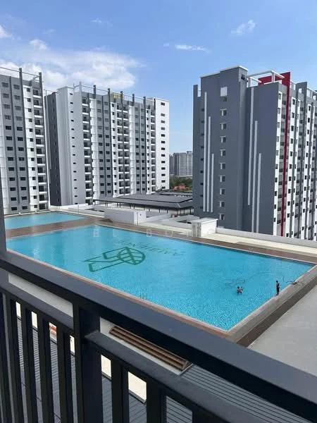
Ambience Residence, KlebangAmbience Residence — Jalan Pulau Gadong — for Rent
1 of 5
Price
RM1,000
Bedroom

2
Bathroom

1
Room type
Single bedroom
Get the latest offer for this unit
Home details
Address
Jalan Pulau Gadong, 75200 Jalan Pulau Gadong, Melaka
Type
Apartment
Nearby points of interest
- school
SK Tengkera 1 & 2
841 m
- school
Sekolah Kebangsaan (Perempuan) Methodist (1)
928 m
- school
Sekolah Menengah Kebangsaan (Perempuan) Methodist
929 m
- school
Melaka International School
995 m
- school
Kindergarten (Tabika Perpaduan)
1.1 km
- school
Oakrich International School
1.1 km
- school
Tadika Al-Aqil
1.1 km
- school
Anglo-Chinese School
1.3 km
- school
Sekolah Menengah Kebangsaan Gajah Berang
1.4 km
- school
Sekolah Menengah Jenis Kebangsaan Katholik
1.8 km
- school
Sekolah Jenis Kebangsaan (Cina) Notre Damee
1.8 km
- school
Sekolah Menengah Jenis Kebangsaan Katholik
1.8 km
- school
Melaka International School
1.8 km
- school
Sekolah Jenis Kebangsaan (Cina) Katholik
1.8 km
- school
Sekolah Menengah Kebangsaan Tun Tuah
1.8 km
- school
Sekolah Menengah Jenis Kebangsaan Notre Dame Convent
1.9 km
- school
Sekolah Jenis Kebangsaan (Cina) Pay Teck
2.0 km
- school
SJK (T) Kubu
2.0 km
- school
SJK (C) Lih Jen
2.1 km
1–5 of 19
Crime intelligence
HighIPD Melaka Tengah · 2023
Total crimes (2023)
984
convictions
vs. Melaka avg
+245%
above state median
Most common
Theft other
29% of total
Density — crimes per 100k residents
156
per 100k · population ~630,000
This district
156
Melaka median
45
Coverage area
Melaka Tengah, Banda Hilir, Bukit Baru, Batu Berendam, Air Keroh
IPD boundaries do not correspond to neighbourhood or administrative boundaries
Crimes by category (2023 convictions)
Theft other
282
Break in
263
Theft vehicle motorcycle
162
Causing injury
76
Robbery gang unarmed
54
Annual trend (IPD Melaka Tengah)
1979
2019
1356
2020
899
2021
874
2022
984
2023
District crime index
100 / 100 · 67th percentile in Melaka
Low
Moderate
High
Conviction-based data from PDRM — not reported incidents. Unreported crimes may not be reflected. Police district boundaries differ from administrative mukim boundaries.
Source: Royal Malaysian Police (PDRM) via data.gov.my · CC BY 4.0
Area flood risk
Seasonal riskJalan Pulau Gadong
Based on the nearest river monitoring station. This reflects flood risk in the surrounding area, not the specific property.
Current discharge
3.3 m³/s
Elevated
Mean discharge
4.2 m³/s
30-day average
Max discharge
14.2 m³/s
30-day peak
Last flooded
No recent floods
Past 2 years
Flood frequency
None recorded
Past 2 years
Monthly flood risk profile
Jan
Feb
Mar
Apr
May
Jun
Jul
Aug
Sep
Oct
Nov
Dec
Low
Moderate
High (monsoon)
DID InfoBanjir tracks water levels in real time. Set up alerts at publicinfobanjir.water.gov.my
Source: Jabatan Pengairan dan Saliran (DID) Malaysia · Open-Meteo