New projects
Subsales
Rentals
 MoreMoreMore
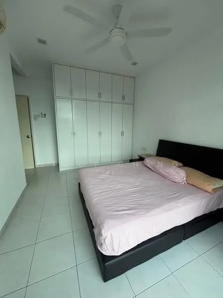
The Peak Residences, Mount Erskine, Tanjung TokongThe Peak Residences — Mount Erskine — for Rent
1 of 5
Price
RM1,800
Bedroom

3
Bathroom

2
Room type
Whole unit
Built-up
1,000 sqft
Carpark

2
Get the latest offer for this unit
Home details
Address
1, 10470 Mount Erskine, Penang
Type
Condominium
Title
Residential
Tenure
Freehold
Room type
Whole unit
Built-up size
1,000 sqft
Carparks
2
Facilities
Ground Level
1
Control centre
2
Outdoor exercise station
3
Seating
4
Jogging path
5
Pocket garden / green area
6
Drop-off zone
Level 6 Facilities Floor
1
Children's play area
2
Clubhouse
3
Wading pool
4
Swimming pool
5
Jacuzzi
6
Reflexology path
Rooftop Garden
1
Viewing spot area
2
Seating and relaxing area
3
Outdoor library
4
Water features
5
4 seasons garden
Nearby points of interest
- school
SMK Tanjong Bunga
1.1 km
- school
Sekolah Ikhtisas Tentera Udara Diraja
1.3 km
- school
Sekolah Jenis Kebangsaan (Cina) Hun Bin
1.3 km
- school
SK Tanjong Tokong
1.5 km
- school
SJK (C) Phor Tay
1.5 km
- school
Phoy Tay Private High School
1.5 km
- school
PCGHS Kindergarten
1.7 km
- school
Penang Chinese Girls Private High School 槟华女子独立中学
1.7 km
- school
Penang Chinese Girls' High School
1.8 km
- school
Sekolah Menengah Jenis Kebangsaan (Cina) Perempuan China
1.8 km
1–5 of 10
Crime intelligence
HighIPD Timur Laut · 2023
Total crimes (2023)
1,241
convictions
vs. Pulau Pinang avg
+78%
above state median
Most common
Theft other
39% of total
Density — crimes per 100k residents
218
per 100k · population ~570,000
This district
218
Pulau Pinang median
122
Coverage area
George Town, Air Itam, Jelutong, Tanjung Tokong, Tanjung Bunga, Pulau Tikus
IPD boundaries do not correspond to neighbourhood or administrative boundaries
Crimes by category (2023 convictions)
Theft other
489
Break in
187
Theft vehicle motorcycle
179
Causing injury
155
Robbery solo unarmed
84
Annual trend (IPD Timur Laut)
1356
2019
1203
2020
1202
2021
1180
2022
1241
2023
District crime index
100 / 100 · 80th percentile in Pulau Pinang
Low
Moderate
High
Conviction-based data from PDRM — not reported incidents. Unreported crimes may not be reflected. Police district boundaries differ from administrative mukim boundaries.
Source: Royal Malaysian Police (PDRM) via data.gov.my · CC BY 4.0
Area flood risk
Low riskMount Erskine
Based on the nearest river monitoring station. This reflects flood risk in the surrounding area, not the specific property.
Current discharge
N/A
Normal
Mean discharge
N/A
30-day average
Max discharge
N/A
30-day peak
Last flooded
No recent floods
Past 2 years
Flood frequency
None recorded
Past 2 years
Monthly flood risk profile
Jan
Feb
Mar
Apr
May
Jun
Jul
Aug
Sep
Oct
Nov
Dec
Low
Moderate
High (monsoon)
DID InfoBanjir tracks water levels in real time. Set up alerts at publicinfobanjir.water.gov.my
Source: Jabatan Pengairan dan Saliran (DID) Malaysia · Open-Meteo