New projects
Subsales
Rentals
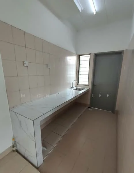
Pangsapuri Randa, Shah AlamPangsapuri Randa — for Rent
1 of 5
Price
RM1,000
Bedroom

3
Bathroom

2
Room type
Whole unit
Built-up
718 sqft
Get the latest offer for this unit
Home details
Type
Apartment
Room type
Whole unit
Built-up size
718 sqft
Facilities
Common Area
1
24-hours security
2
Playground
3
Badminton court
Nearby points of interest
- school
SK Bukit Rimau
432 m
- school
SJK (C) Chung Hua Klang 巴生中华华文小学
489 m
- school
SRI Al-Thaqafah
733 m
- school
Chinese Taipei School (Kuala Lumpur)
751 m
- school
Sekolah Menengah Kebangsaan Kota Kemuning
1.4 km
- school
Sekolah Kebangsaan Bukit Kemuning 2
1.5 km
- school
Sekolah Kebangsaan Kota Kemuning
1.9 km
- school
SK Jalan Kebun
2.4 km
- school
SJK (C) Khe Beng, Klang
2.5 km
- school
SMK Jalan Kebun
2.8 km
1–5 of 10
Crime intelligence
ModerateIPD Shah Alam · 2023
Total crimes (2023)
792
convictions
vs. Selangor avg
−10%
below state median
Most common
Theft vehicle motorcycle
31% of total
Density — crimes per 100k residents
120
per 100k · population ~660,000
This district
120
Selangor median
133
Coverage area
Shah Alam
IPD boundaries do not correspond to neighbourhood or administrative boundaries
Crimes by category (2023 convictions)
Theft vehicle motorcycle
248
Theft other
154
Break in
119
Theft vehicle motorcar
65
Causing injury
54
Annual trend (IPD Shah Alam)
1112
2019
866
2020
853
2021
782
2022
792
2023
District crime index
45 / 100 · 40th percentile in Selangor
Low
Moderate
High
Conviction-based data from PDRM — not reported incidents. Unreported crimes may not be reflected. Police district boundaries differ from administrative mukim boundaries.
Source: Royal Malaysian Police (PDRM) via data.gov.my · CC BY 4.0
Flood risk
Low riskBased on Canal Gardens, the closest river — its water level and flow, not your exact unit. Every reading below tracks the river flooding, not the building, and your ground may sit higher or lower than the river itself.
Low flood risk to this building
Canal Gardens shows low flood activity, but the building ground sits ≈8 m above it. River flooding reaching this building is very unlikely — Canal Gardens would have to rise about 3 floors first.
Covers river flooding only — flash floods from heavy rain or blocked drains can still affect higher ground. Elevations are approximate (~90 m resolution).
River discharge — water flowing through Canal Gardens, not the building · activity low
Current discharge
N/A
Normal
Mean discharge
N/A
30-day average
Max discharge
N/A
30-day peak
Height above sea level
This building
≈20 m
Canal Gardens
780 m away
≈12 m
Building sits ≈8 m above Canal Gardens
Canal Gardens overflow history — when the river flooded, not the building
River last flooded
No recent floods
Past 2 years
River floods
None recorded
Past 2 years
Monthly river flood risk
Jan
Feb
Mar
Apr
May
Jun
Jul
Aug
Sep
Oct
Nov
Dec
Low
Moderate
High (monsoon)
DID InfoBanjir tracks water levels in real time. Set up alerts at publicinfobanjir.water.gov.my
Source: Jabatan Pengairan dan Saliran (DID) Malaysia · Open-Meteo