New projects
Subsales
Rentals
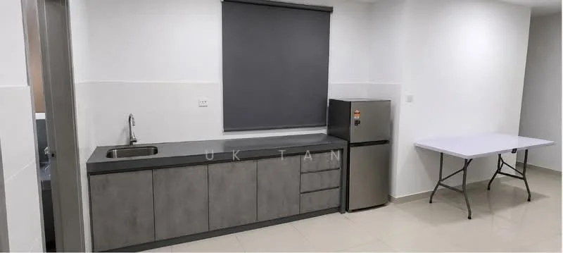
Residensi PV18, Taman Setapak, SetapakResidensi PV18 — Taman Setapak — for Rent
1 of 5
Price
RM2,000
Bedroom

3
Bathroom

2
Room type
Whole unit
Built-up
1,024 sqft
Carpark

1
Get the latest offer for this unit
Home details
Address
Jalan Langkawi Jalan Langkawi, Taman Setapak, Kuala Lumpur
Type
Condominium
Room type
Whole unit
Built-up size
1,024 sqft
Carparks
1
Facilities
Recreational Level
1
Infinity Swimming Pool
2
Gymnasium
3
Basketball Court
4
BBQ Area
5
Multipurpose Hall
6
Playground
Nearby points of interest
- school
Sekolah Menengah Kebangsaan Danau Kota
194 m
- school
Sekolah Kebangsaan Danau Kota 2
208 m
- school
Sekolah Rendah Agama At-Taqwa
682 m
- school
SJK (C) Lee Rubber 南益华文小学
717 m
- school
Sekolah Jenis Kebangsaan (Cina) Mun Yee
930 m
- school
SJK (C) Wangsa Maju
932 m
- school
Chong Hwa Secondary School
1.0 km
- school
Sekolah Kebangsaan Danau Kota
1.1 km
- school
SK Mariam Convent
1.3 km
- school
SK(2) Gombak
1.3 km
1–5 of 10
Crime intelligence
HighIPD Sentul · 2023
Total crimes (2023)
1,101
convictions
vs. Kuala Lumpur avg
+36%
above state median
Most common
Theft other
28% of total
Density — crimes per 100k residents
124
per 100k · population ~888,000
This district
124
Kuala Lumpur median
91
Coverage area
Sentul, Wangsa Maju, Setapak, Kepong, Jinjang, Setiawangsa, Danau Kota
IPD boundaries do not correspond to neighbourhood or administrative boundaries
Crimes by category (2023 convictions)
Theft other
303
Theft vehicle motorcycle
269
Theft vehicle motorcar
159
Break in
125
Causing injury
81
Annual trend (IPD Sentul)
2515
2019
1849
2020
1545
2021
1164
2022
1101
2023
District crime index
100 / 100 · 83rd percentile in Kuala Lumpur
Low
Moderate
High
Conviction-based data from PDRM — not reported incidents. Unreported crimes may not be reflected. Police district boundaries differ from administrative mukim boundaries.
Source: Royal Malaysian Police (PDRM) via data.gov.my · CC BY 4.0
Flood risk
Low risk (area)Taman Setapak
Based on the closest river — its water level and flow, not your exact unit. Every reading below tracks the river flooding, not the building, and your ground may sit higher or lower than the river itself.
Showing area river-flood risk — we couldn't measure this building's height above the river.
River discharge — water flowing through the nearest river, not the building · activity low
Current discharge
N/A
Normal
Mean discharge
N/A
30-day average
Max discharge
N/A
30-day peak
River overflow history — when the river flooded, not the building
River last flooded
No recent floods
Past 2 years
River floods
None recorded
Past 2 years
Monthly river flood risk
Jan
Feb
Mar
Apr
May
Jun
Jul
Aug
Sep
Oct
Nov
Dec
Low
Moderate
High (monsoon)
DID InfoBanjir tracks water levels in real time. Set up alerts at publicinfobanjir.water.gov.my
Source: Jabatan Pengairan dan Saliran (DID) Malaysia · Open-Meteo