New projects
Subsales
Rentals
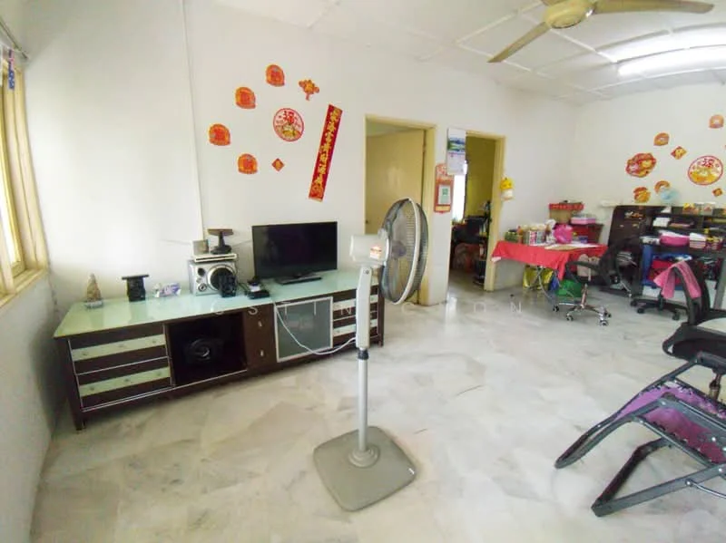
Pandan Lake View, Pandan Perdana, AmpangPandan Lake View — for Sale
1 of 5
Price
RM220,000
Bedroom

3
Bathroom

2
Built-up
828 sqft
Carpark

1
Get the latest offer for this unit
Home details
Price per sqft
RM265.70 psf
Built-up size
828 sqft
Carparks
1
Furnished
Yes
Title
Strata
Tenure
Leasehold
Type
Apartment
Facilities
Ground floor
1
Parking
2
Security Guards
3
Perimeter Fencing
4
Millenium Curry House Restaurant
5
Communal areas
6
Community gardens
Nearby points of interest
- school
Sekolah Kebangsaan Pandan Perdana
303 m
- school
Sekolah Kebangsaan Kampung Cheras Baharu
841 m
- school
Sekolah Kebangsaan Cheras Indah
1.0 km
- school
KAFA Integrasi Al-Huda
1.0 km
- school
Sekolah Menengah Kebangsaan Pandan Indah
1.0 km
- school
Kompleks Seri Bintang
1.2 km
- school
Sekolah Rendah Integrasi Teras Islam Al-Jundi
1.2 km
- school
Sekolah Kebangsaan Pandan Indah
1.3 km
- school
Sekolah Kebangsaan Taman Muda
1.3 km
- school
Sekolah Rendah Agama An-Nur
1.5 km
1–5 of 10
Market intelligence
103 transactionsTMN PANDAN PERDANA · Hulu Langat
RM 265.70 psf
This listing
-30.0%vs project median
RM 180
RM 379 (median)
RM 1,093
Cheapest in project
Most expensive
Median PSF
379.46
RM per sq.ft
Median price
315K
24-month median
PSF trend
-20.7%
12-month change
PSF by floor level
L1-5
RM305.05
(46)
L6-10
RM376.63
(10)
L16-20
RM363.53
(2)
Source: NAPIC (National Property Information Centre) · Hulu Langat
Crime intelligence
HighIPD Ampang Jaya · 2023
Total crimes (2023)
1,174
convictions
vs. Selangor avg
+34%
above state median
Most common
Theft other
34% of total
Density — crimes per 100k residents
419
per 100k · population ~280,000
This district
419
Selangor median
314
Coverage area
Ampang Jaya, Pandan Indah, Taman Melawati
IPD boundaries do not correspond to neighbourhood or administrative boundaries
Crimes by category (2023 convictions)
Theft other
401
Theft vehicle motorcycle
228
Break in
223
Theft vehicle motorcar
81
Causing injury
69
Annual trend (IPD Ampang Jaya)
2163
2019
1899
2020
1295
2021
992
2022
1174
2023
District crime index
66 / 100 · 67th percentile in Selangor
Low
Moderate
High
Conviction-based data from PDRM — not reported incidents. Unreported crimes may not be reflected. Police district boundaries differ from administrative mukim boundaries.
Source: Royal Malaysian Police (PDRM) via data.gov.my · CC BY 4.0
Flood risk
Moderate riskBased on Sungai Kerayong, the closest river — its water level and flow, not your exact unit. Every reading below tracks the river flooding, not the building, and your ground may sit higher or lower than the river itself.
Moderate flood risk to this building
Sungai Kerayong shows low flood activity, but the building ground sits ≈7 m below it. This building sits below Sungai Kerayong, so river flooding is a real concern — check drainage and past flooding closely.
Covers river flooding only — flash floods from heavy rain or blocked drains can still affect higher ground. Elevations are approximate (~90 m resolution).
River discharge — water flowing through Sungai Kerayong, not the building · activity low
Current discharge
N/A
Normal
Mean discharge
N/A
30-day average
Max discharge
N/A
30-day peak
Height above sea level
This building
≈55 m
Sungai Kerayong
221 m away
≈62 m
Building sits ≈7 m below Sungai Kerayong
Sungai Kerayong overflow history — when the river flooded, not the building
River last flooded
No recent floods
Past 2 years
River floods
None recorded
Past 2 years
Monthly river flood risk
Jan
Feb
Mar
Apr
May
Jun
Jul
Aug
Sep
Oct
Nov
Dec
Low
Moderate
High (monsoon)
DID InfoBanjir tracks water levels in real time. Set up alerts at publicinfobanjir.water.gov.my
Source: Jabatan Pengairan dan Saliran (DID) Malaysia · Open-Meteo