New projects
Subsales
Rentals
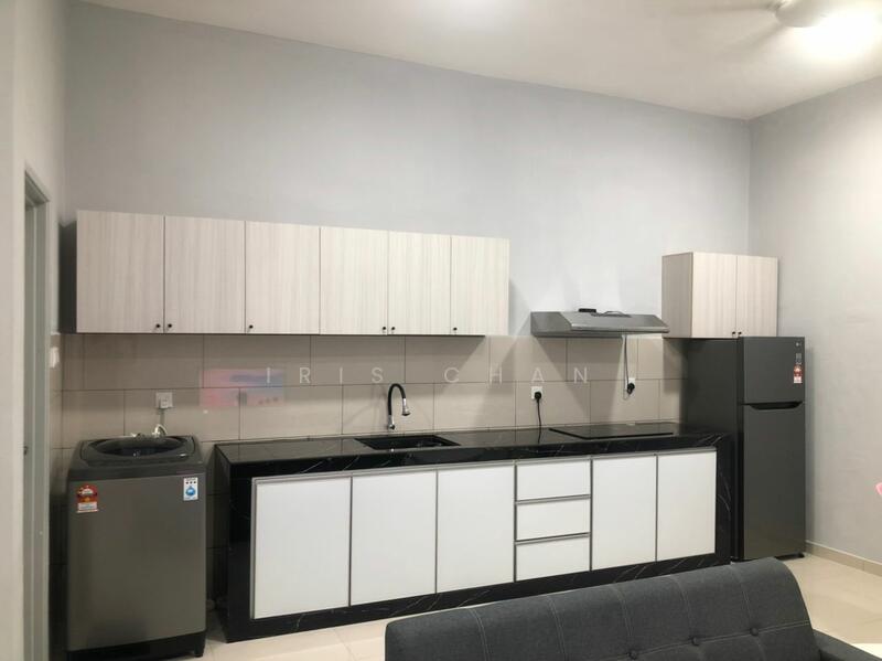
Mahkota Valley @ Indera Mahkota, Bandar Indera Mahkota, KuantanMahkota Valley @ Indera Mahkota — Bandar Indera Mahkota — for Rent
1 of 4
Price
RM1,400
Bedroom

Studio
Bathroom

1
Room type
Whole unit
Built-up
465 sqft
Get the latest offer for this unit
Home details
Address
Jalan IM 9/2, 25200 Bandar Indera Mahkota, Pahang
Type
Condominium
Title
Strata
Tenure
Leasehold
Room type
Whole unit
Built-up size
465 sqft
Facilities
Ground Floor
1
Infinity pool
2
Children's pool
3
Children's playground
4
Outdoor play equipment
5
Garden
6
Gymnasium
Nearby points of interest
- school
International School of Kuantan
1.1 km
- school
Sekolah Berasrama Penuh Integrasi Kuantan
1.4 km
- school
Sekolah Jenis Kebangsaan (Tamil) Bandar Indera Mahkota
1.7 km
- school
Sekolah Kebangsaan Tunku Azizah
1.7 km
- school
SMK Astana
1.8 km
- school
SJK(C) Kuang Hwa
1.8 km
- school
Sekolah Kebangsaan Indera Mahkota Utama
1.9 km
- school
SMK Tengku Panglima Perang Tengku Muhamad
2.1 km
- school
MAAZ Integrated Islamic School
2.1 km
- school
SMK Indera Mahkota 2
2.4 km
1–5 of 10
Crime intelligence
HighIPD Kuantan · 2023
Total crimes (2023)
601
convictions
vs. Pahang avg
+401%
above state median
Most common
Theft vehicle motorcycle
28% of total
Density — crimes per 100k residents
105
per 100k · population ~571,000
This district
105
Pahang median
21
Coverage area
Kuantan, Gambang, Beserah
IPD boundaries do not correspond to neighbourhood or administrative boundaries
Crimes by category (2023 convictions)
Theft vehicle motorcycle
168
Break in
136
Theft other
128
Causing injury
54
Theft vehicle motorcar
39
Annual trend (IPD Kuantan)
1274
2019
889
2020
835
2021
673
2022
601
2023
District crime index
100 / 100 · 91st percentile in Pahang
Low
Moderate
High
Conviction-based data from PDRM — not reported incidents. Unreported crimes may not be reflected. Police district boundaries differ from administrative mukim boundaries.
Source: Royal Malaysian Police (PDRM) via data.gov.my · CC BY 4.0
Flood risk
Moderate riskBandar Indera Mahkota
Based on the closest river — its water level and flow, not your exact unit. Every reading below tracks the river flooding, not the building, and your ground may sit higher or lower than the river itself.
Moderate flood risk to this building
Nearest river shows low flood activity, but the building ground sits ≈0 m above it. River flooding could reach this building in an extreme event — the nearest river would need to rise about 1 floor.
Covers river flooding only — flash floods from heavy rain or blocked drains can still affect higher ground. Elevations are approximate (~90 m resolution).
River discharge — water flowing through the nearest river, not the building · activity low
Current discharge
66.9 m³/s
Normal
Mean discharge
71.9 m³/s
30-day average
Max discharge
151.1 m³/s
30-day peak
Height above sea level
This building
≈23 m
Nearest river
484 m away
≈23 m
Building is about level with the nearest river
River overflow history — when the river flooded, not the building
River last flooded
No recent floods
Past 2 years
River floods
None recorded
Past 2 years
Monthly river flood risk
Jan
Feb
Mar
Apr
May
Jun
Jul
Aug
Sep
Oct
Nov
Dec
Low
Moderate
High (monsoon)
DID InfoBanjir tracks water levels in real time. Set up alerts at publicinfobanjir.water.gov.my
Source: Jabatan Pengairan dan Saliran (DID) Malaysia · Open-Meteo